Skip to content
Tap to Lanka
Back to your trip

Upper Kotmale Dam Viewpoint

Nuwara Eliya, Nuwara Eliya District

Get directions

Discover Upper Kotmale Dam Viewpoint near Talawakelle, a scenic highland destination overlooking an impressive hydroelectric dam and reservoir. Surrounded by green hills, tea plantations, and misty mountain scenery, the viewpoint offers beautiful landscapes and insights into Sri Lanka's renewable en

Best time to visit
Early morning or late afternoon
Opening hours
Public viewpoint hours have not been officially verified.
Entry fee
Free
Dress code
Comfortable outdoor clothing, suitable walking shoes, and a light jacket.
Time needed
20–45 minutes

Highlights

  • Impressive Upper Kotmale hydroelectric dam
  • Scenic reservoir surrounded by green highland mountains
  • Panoramic views of water and mountain landscapes
  • Major renewable energy project with 150 MW capacity
  • Concrete gravity dam approximately 35.5 metres high
  • Beautiful mist-covered hills and countryside scenery
  • Hydroelectric engineering and water-management infrastructure
  • Landscape and architectural photography opportunities
  • Surrounding tea plantations and highland vegetation
  • Connection to the Kotmale Oya river system
  • Nearby St. Clair's Falls and Talawakelle attractions
  • Distinctive engineering and nature destination in Nuwara Eliya

Upper Kotmale Dam Viewpoint - A Scenic Highland Engineering Landmark

Upper Kotmale Dam Viewpoint is a scenic attraction located near Talawakelle in the Nuwara Eliya District of Sri Lanka's Central Province. Overlooking the Upper Kotmale Dam and its reservoir, the area offers visitors an impressive combination of hydroelectric engineering, beautiful water landscapes, green mountains, and the natural beauty of Sri Lanka's central highlands.

The viewpoint is particularly appealing to nature lovers, photographers, engineering enthusiasts, and travellers exploring the scenic hill-country region.

History and Development of Upper Kotmale Dam

Upper Kotmale Dam was constructed as part of the Upper Kotmale Hydropower Project, one of Sri Lanka's significant renewable energy developments.

The project was developed to harness the water resources of the Kotmale Oya River and contribute electricity to the national power system.

Supported by Japanese development financing, the project became an important part of Sri Lanka's hydroelectric infrastructure and was officially commissioned in 2012.

The development represents a major engineering achievement in the country's mountainous central region.

Dam Structure and Engineering Features

Upper Kotmale Dam is a concrete gravity dam measuring approximately 35.5 metres in height and 180 metres in length.

The dam creates a reservoir that stores and regulates water for hydroelectric generation.

The project includes an approximately 12.89-kilometre underground headrace tunnel that carries water towards the underground power station at Niyamgamdora.

With an installed generation capacity of 150 megawatts, the hydropower facility contributes to Sri Lanka's renewable electricity supply.

Visitors can appreciate the scale of the dam and its surrounding infrastructure from suitable, permitted viewing locations.

Scenic Reservoir and Mountain Landscapes

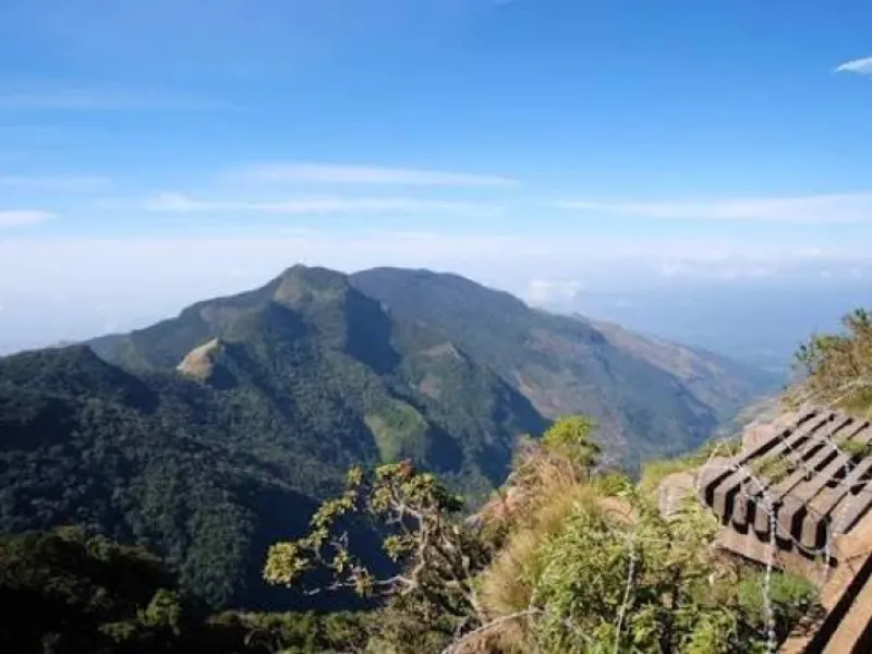
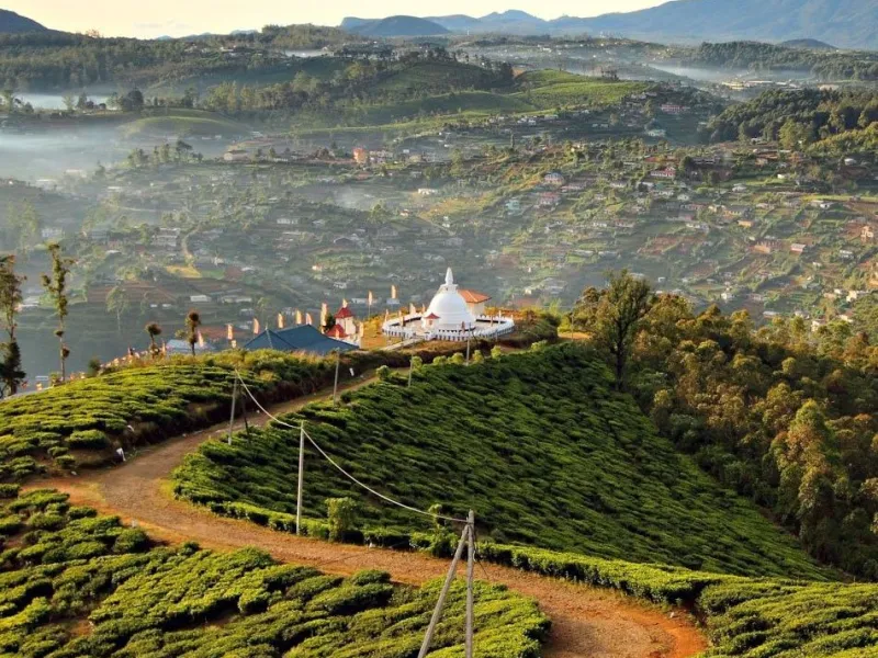
One of the main attractions of Upper Kotmale Dam Viewpoint is the beautiful reservoir surrounded by green hills and highland vegetation.

The calm reservoir waters, steep mountain slopes, and surrounding countryside create picturesque landscapes, particularly during clear mornings.

Mist frequently moves across the hill-country landscape, giving the area a peaceful and atmospheric appearance.

The combination of water, mountains, and engineering structures makes the location an interesting stop for sightseeing and photography.

Hydroelectric Power and Renewable Energy

Upper Kotmale Hydropower Project plays an important role in Sri Lanka's renewable energy sector.

The facility uses flowing water to generate electricity through underground turbines, reducing reliance on fossil-fuel-based electricity generation.

The reservoir, dam, water-conveyance tunnel, and power station form an integrated hydropower system designed to supply electricity to the national grid.

For students and engineering enthusiasts, the destination provides an opportunity to understand how hydroelectric infrastructure operates within Sri Lanka's central highlands.

Environmental Importance and St. Clair's Falls

The Upper Kotmale project is located within the wider Kotmale Oya river system, which is closely associated with the scenic landscapes and waterfalls of the Talawakelle region.

St. Clair's Falls, one of Sri Lanka's well-known waterfalls, is located downstream within the same river system.

The hydropower project's construction and water diversion have influenced downstream river flows, including those associated with St. Clair's Falls.

Environmental management measures, including regulated water releases, form an important part of the project's operation.

This relationship highlights the importance of balancing renewable energy development with the conservation of natural river environments.

Photography and Sightseeing Experiences

Upper Kotmale Dam Viewpoint offers attractive photography opportunities featuring the concrete dam, reservoir waters, surrounding vegetation, and mountain scenery.

Early morning and late afternoon can provide beautiful natural lighting for landscape photography.

Visitors should use permitted viewing areas and avoid entering operational structures, restricted roads, or unsafe reservoir edges.

The appearance of the reservoir and spillway may change depending on rainfall, water levels, and hydropower operations.

A Distinctive Destination Near Talawakelle

Upper Kotmale Dam Viewpoint is a worthwhile destination for visitors travelling through Talawakelle and the surrounding Nuwara Eliya highlands.

Its combination of scenic mountain views, reservoir landscapes, hydroelectric engineering, and regional environmental significance makes it more than an ordinary sightseeing location.

Visitors are encouraged to respect operational restrictions, follow safety instructions, and enjoy the surrounding natural beauty responsibly.
Photos

How to get there

Upper Kotmale Dam Viewpoint is located near Talawakelle town in the Nuwara Eliya District of Sri Lanka's Central Province. Visitors travelling from Nuwara Eliya can follow the road towards Talawakelle through the scenic highland region, passing tea plantations, mountain landscapes, and local settlements. Travellers arriving from Hatton can use the A7 road towards Talawakelle and continue towards the Upper Kotmale Reservoir area. Visitors travelling from Colombo or Kandy can reach Talawakelle by road or by train along Sri Lanka's Main Line before continuing towards the viewpoint using local transportation. Private vehicles, taxis, and three-wheelers may be convenient for reaching a suitable public viewing location. The Upper Kotmale Reservoir viewpoint is listed along the Tawalantenne–Talawakelle Road. Visitors should confirm the exact safe stopping area before travelling. Confirm that the chosen access point is open to visitors, and avoid entering restricted hydropower facilities or dam infrastructure.

Tips for visitors

Visit during daylight hours for better reservoir and mountain views. Check the local weather forecast before travelling. Carry a light jacket because Talawakelle can have cool and misty weather. Use designated or clearly permitted public viewing areas. Never enter restricted dam, spillway, or power station facilities. Do not climb fences, barriers, or operational structures. Avoid approaching steep reservoir banks or unstable slopes. Stay away from water-release channels and downstream spillway areas. Do not swim, fish, or enter reservoir waters without explicit authorisation. Avoid visiting exposed areas during heavy rainfall or severe weather. Keep children accompanied near roads, steep slopes, and water. Park vehicles only in safe, permitted locations. Take photographs without obstructing roads or operational activities. Respect security instructions and the surrounding environment. Keep the viewpoint clean and avoid leaving plastic waste.

Frequently asked questions

Where is Upper Kotmale Dam Viewpoint located?

Upper Kotmale Dam Viewpoint is located near Talawakelle in the Nuwara Eliya District of Sri Lanka's Central Province. The viewpoint overlooks the Upper Kotmale Dam and Reservoir, surrounded by scenic highland landscapes. Visitors can use GPS coordinates 6.9481055, 80.6598609 for navigation and should confirm the permitted viewing location before travelling.

What makes Upper Kotmale Dam Viewpoint special?

Upper Kotmale Dam Viewpoint is known for its impressive hydroelectric dam, scenic reservoir, and surrounding green mountains. The dam is approximately 35.5 metres high and 180 metres long and supports a 150 MW hydropower project. The combination of renewable energy engineering and beautiful highland scenery makes it a distinctive attraction near Talawakelle.

What is the best time to visit Upper Kotmale Dam Viewpoint?

Early morning and late afternoon are generally recommended for enjoying the reservoir scenery and mountain landscapes. Clear weather provides better visibility, while mist can create atmospheric views. January to April may offer favourable sightseeing conditions, although rainfall and changing weather can occur throughout the year.

What are the opening hours and entrance fees for Upper Kotmale Dam Viewpoint?

Official public viewpoint opening hours and entrance fees have not been independently verified. Viewing from permitted public roadside areas may be possible without an admission fee, while access to dam infrastructure and operational facilities may require special permission. Visitors should confirm current access arrangements before travelling.

What can visitors do at Upper Kotmale Dam Viewpoint, and what safety precautions should they follow?

Visitors can enjoy panoramic views of the Upper Kotmale Reservoir, surrounding mountains, and hydroelectric dam from permitted public viewing areas. The location is suitable for landscape photography and learning about renewable energy infrastructure. Visitors should stay away from restricted facilities, steep reservoir edges, spillway areas, and water-release channels while following all safety instructions.

Visitor reviews

No reviews yet. Been here? Share your tips for other visitors.

Sign in to write a review
Suggest an edit or report wrong info

More places nearby

See all →
World's End Viewpoint
Mountains, hikes & viewpoints Must see

World's End Viewpoint

Hatton, Nuwara Eliya District

World's End is a spectacular cliff viewpoint in Horton Plains National Park, famous for its dramatic vertical drop and breathtaking panoramic views of Sri Lanka's Central Highlands, valleys and distant southern coastline.

Single Tree Hill (One Tree Hill)
Mountains, hikes & viewpoints

Single Tree Hill (One Tree Hill)

Nuwara Eliya, Nuwara Eliya District

Single Tree Hill is a scenic mountain viewpoint rising approximately 2,100 metres above sea level in Nuwara Eliya. Famous for its breathtaking sunrise views, lush tea plantations and panoramic scenery of Gregory Lake and surrounding mountains.

Moon Plains Viewpoint
Mountains, hikes & viewpoints

Moon Plains Viewpoint

Nuwara Eliya, Nuwara Eliya District

Moon Plains (Sandathenna) is a scenic highland plateau near Nuwara Eliya, famous for its 360-degree mountain views, rolling green grasslands, wildlife and Mini World's End viewpoint. Visitors can explore its beautiful landscapes on a memorable jeep safari.

Singimale Nature Reserve
Mountains, hikes & viewpoints

Singimale Nature Reserve

Nuwara Eliya, Nuwara Eliya District

Explore Singimale Nature Reserve near Hatton, a scenic highland forest destination surrounded by lush greenery, mist-covered hills, and diverse natural habitats. Discover peaceful mountain landscapes, nature photography opportunities, and the nearby historic Singimale Railway Tunnel in Sri Lanka's c

St. Clair's Falls
Mountains, hikes & viewpoints

St. Clair's Falls

Talawakele, Nuwara Eliya District

St. Clair's Falls, known as the "Little Niagara of Sri Lanka," is one of the country's widest waterfalls, located near Talawakele. Famous for its beautiful twin cascades, lush tea plantations and breathtaking mountain scenery.

Ambewela Farm Viewpoint
Mountains, hikes & viewpoints

Ambewela Farm Viewpoint

Nuwara Eliya, Nuwara Eliya District

Scenic highland viewpoint near Nuwara Eliya, offering beautiful views of rolling green pastures, dairy farms, mist-covered hills, and the peaceful countryside of Ambewela.

Get directions Plan trip